The Best Cartography and Map Books
“What are the best map and cartography books?” We looked at 11 lists and came away with 141 different books perfect for any lover of the craft.
Maps, like the human beings who create them, have evolved and grown more complicated as time goes on. Maps have progressed from their early days of charting and making sense of land and the sky. Now maps can be used for almost anything, you can make a map of the human mind, the interconnectedness of communities, the internet, and even galaxies. As a cheesy or over-earnest teacher might say “The only limit to creating new and exciting maps is your imagination”.
Below you will find 141 of the best books about maps, cartography, map makers, map design and every creative map you can think of. The top 13 books appearing on multiple lists can be found with images and link below and the remaining 128 (as well as the sources we consulted) can be found at the bottom of the page.
Happy Scrolling!
The Best Map and Cartography Books
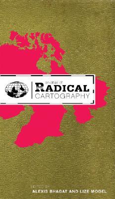
13.) An Atlas of Radical Cartography by Lize Mogel
- Bellerby And Co
- Brain Pickings
An Atlas of Radical Cartography makes an important contribution to a growing cultural movement that traverses the boundaries between art, cartography, geography and activism. It pairs writers with artists, architects, designers and collectives to address the role of the map as political agent (rather than neutral document). Ten mapping projects dealing with social and political issues such as migration, incarceration, globalization, housing rights, garbage and energy issues are complemented by 10 critical essays and dialogues responding to each map.
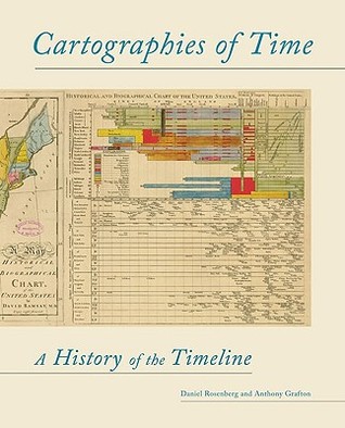
12.) Cartographies of Time: A History of the Timeline by Daniel Rosenberg
- Brain Pickings
- Wired
Now in Paperback! What does history look like? How do you draw time? Cartographies of Time is the first history of the timeline, written engagingly and with incredible visuals. The authors, both accomplished writers and historians, sketch the shifting field of graphic representations of history from the beginning of the print age through the present. They shed light on western views of history and on the complex relationship between general ideas about the course of events and the technical efforts to record and connect dates and names in the past. In addition to telling a rich, forgotten story, this book serves as a kind of grammar of historical representation, uncovering the ways in which time has been structured in thought and in images, in the Western tradition. Written for both the academically curious and the general reader, Cartographies of Time provides a set of tools for understanding the evolution and the significance of graphic representations of time both in history and in contemporary culture.
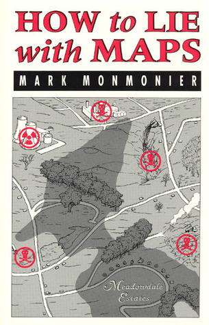
11.) How To Lie With Maps by Mark Monmonier
- Gretchen Peterson
- Wired
Originally published to wide acclaim, this lively, cleverly illustrated essay on the use and abuse of maps teaches us how to evaluate maps critically and promotes a healthy skepticism about these easy-to-manipulate models of reality. Monmonier shows that, despite their immense value, maps lie. In fact, they must.
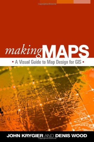
10.) Making Maps: A Visual Guide to Map Design for GIS by John Krygier and Denis Wood
- Fantom Planet
- Wired
Acclaimed for its innovative use of visual material, this book is engaging, clear, and compelling—exactly how an effective map should be. Nearly every page is organized around maps and other figures (many in full color) that illustrate all aspects of map making, including instructive examples of both good and poor design choices. The book covers everything from locating and processing data to making decisions about layout, symbols, color, and type. Readers are invited to think critically about both the technical features and social significance of maps as they learn to create better maps of their own.
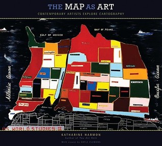
9.) Map As Art, The: Contemporary Artists Explore Cartography by Katharine Harmon
- Brain Pickings
- The New York Times
It is little surprise that in an era of globalized politics, culture, and ecology contemporary artists are drawn to mapsto express their visions. Using paint, salt, souvenir tea towels, or their own bodies, map artists explore a world free ofgeographical constraints. In The Map as Art, Harmon collects 360 colorful, map-related artistic visions by well-known artists—such as Ed Ruscha, Julian Schnabel, Olafur Eliasson, William Kentridge, and Vik Muniz—and many more less-familiar artists for whom maps are the inspiration for creating art. Essays by Gayle Clemans bring an in-depth look into the artists’ maps of Joyce Kozloff, Landon Mackenzie, Ingrid Calame, Guillermo Kuitca, and Maya Lin. Together, the beautiful reproductions and telling commentary make this an essential volume for anyone open to exploring new paths.
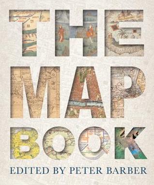
8.) The Map Book by Peter Barber
- Gretchen Peterson
- Map History
From the earliest of times, maps have fired our imaginations and helped us make sense of our world, from the global to the very local. Head of Map Collections at the British Library, Peter Barber has here compiled an historic and lavish atlas, charting the progress of civilization as our knowledge of the world expanded. Simply organized as a progression through time, The Map Book collects some 175 maps that span four millennia – from the famed prehistoric Bedolina (Italy) incision in rock from around 1500 B.C. to the most modern, digitally enhanced rendering. Many of the maos are beautiful works of art in their own right. From Europe to the Americas, Africa to Asia, north to south, there are maps of oceans and continents charted by heroic adventurers sailing into the unknown, as accounts spread of new discoveries, shadowy continents begin to appear n the margins of the world, often labeled ‘unknown lands.’ Other maps had a more practical use: some demarcated national boundaries or individual plots of land; military plans depicted enemy positions; propaganda treatises showed one country or faction at an advantage over others.
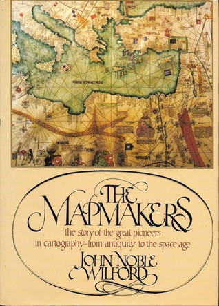
7.) The Mapmakers: The Story of the Great Pioneers in Cartography – from Antiquity to the Space Age by John Noble Wilford
- Wired
- Map History
In his classic text, two-time Pulitzer Prize—winner John Noble Wilford recounts the history of cartography from antiquity to the space age. With this revised edition, Wilford brings the story up to the present day, as he shows the impact of new technologies that make it possible for cartographers to go where no one has been before, from the deepest reaches of the universe (where astronomers are mapping time as well as space) to the inside of the human brain. These modern-day mapmakers join the many earlier adventurers–including ancient Greek stargazers, Renaissance seafarers, and the explorers who mapped the American West–whose exploits shape this dramatic story of human inventiveness and limitless curiosity.
6.) Times Atlas of the World by Times Books
- Independent
- About
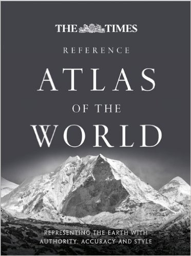
The Times Comprehensive Atlas of the World continues to be the benchmark of cartographic excellence, relied on and trusted by governments, media companies, and international organizations around the world including the UN and the European Commission. New features include a double page map of the Arctic Ocean, new maps of sub-ice features in the Arctic Ocean and the Antarctic, and physical maps of all the continents. Major updates include 5,000 place name changes, most notably in Iran, Japan, Brazil, South Korea, Taiwan, and Spain; a beautifully illustrated section on current issues from climate to economy; updated national parks and conserved areas including the Kavango Zambezi Transfrontier Conservation Area (KAZA TFCA), the largest conservation zone in the world; and towns and populations in Brazil and Japan.
5.) You Are Here: Personal Geographies and Other Maps of the Imagination by Katherine Harmon
- Brain Pickings
- Wired
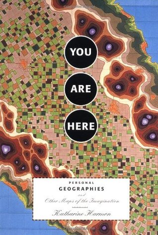
Mapmaking fulfills one of our most ancient and deepseated desires: understanding the world around us and our place in it. But maps need not just show continents and oceans: there are maps to heaven and hell; to happiness and despair; maps of moods, matrimony, and mythological places. There are maps to popular culture, from Gulliver’s Island to Gilligan’s Island. There are speculative maps of the world before it was known, and maps to secret places known only to the mapmaker. Artists’ maps show another kind of uncharted realm: the imagination. What all these maps have in common is their creators’ willingness to venture beyond the boundaries of geography or convention.
4.) From Here To There by Hand Drawn Map Association
- Bellerby And Co
- Brain Pickings
- Wired
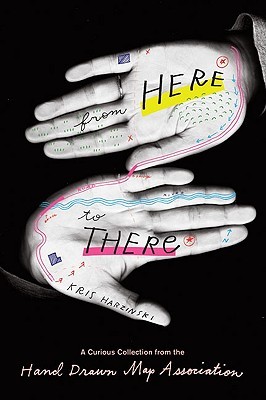
From Here to There celebrates these ephemeral documentsusually forgotten or tossed aside after having served their purposegiving them their due as artifacts representing stories from people’s lives around the world. There is the young woman suffering from juvenile rheumatoid arthritis who created maps of the Humira injections on her stomach and thighs to help her remember the sites, and give them time to heal. Or the young boy who imagined a whole country for ants and put it to paper. Lucas from Australia drew an obsessively detailed map of his local traffic island, and a teenage girl contributed a map of her high school locker. Two American tourists got lost in the Bulgarian mountains following the hand drawn map of a local, and Britanny from Denmark drew directions to an animal rights protest in Copenhagen. The maps featured in From Here to There are as varied and touching as the stories they tell.
3.) On The Map : Why The World Looks The Way It Does by Simon Garfield
- Bellerby And Co
- Here 360
- Map History
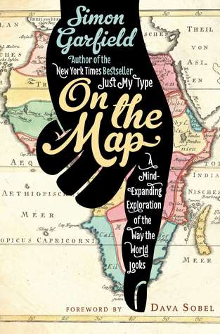
Imagine a world without maps. How would we travel? Could we own land? What would men and women argue about in cars? Scientists have even suggested that mapping—not language—is what elevated our prehistoric ancestors from ape-dom. Follow the history of maps from the early explorers’ maps and the awe-inspiring medieval Mappa Mundi to Google Maps and the satellite renderings on our smartphones, Garfield explores the unique way that maps relate and realign our history—and reflect the best and worst of what makes us human.
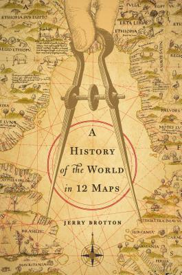
1. (Tie) A History of the World in Twelve Maps by Jerry Brotton
- Bellerby And Co
- Here 360
- Map History
- Wired
Maps are objects of endless fascination, and the urge to map is a basic human instinct. In this masterful study, historian and cartography expert Jerry Brotton reveals how maps—far from being objective documents—are intimately tied to the views and agendas of particular times and places. Beginning with Ptolemy’s Geography and ending with the satellite-powered behemoth of Google Earth, Brotton examines a dozen world maps from around the globe and through the centuries to trace the long road to our present geographical reality.
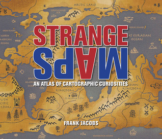
1. (Tie) Strange Maps: An Atlas of Cartographic Curiosities by Frank Jacobs
- Bellerby And Co
- Brain Pickings
- Gretchen Peterson
- The New York Times
Spanning many centuries, all continents, and the realms of outer space and the imagination, this collection of 138 unique graphics combines beautiful full-color illustrations with quirky statistics and smart social commentary. The result is a distinctive illustrated guide to the world.
The Best Map and Cartography Books
Books 14-141 (Appear on 1 list each)
| 1000 Fonts | Martin | Gretchen Peterson |
| A Guide to Collecting Antique Maps | Christopher W. Lane | Map History |
| A History of the Twentieth Century in 100 Maps | Tim Bryars & Tom Harper | Map History |
| A World Map app Jaja & Co | Independent | |
| Advanced Spatial Analysis: The CASA Book of GIS | Paul A. Longley, Michael Batty | Fantom Planet |
| Adventures of Paul Theroux | Paul Theroux | Bellerby And Co |
| Alte Landkarten: von der Antike bis zum Ende des 19. Jahrhunderts | Ivan Kupcik | Map History |
| Animals and Maps | Wilma George | Map History |
| Antique Maps | Carl Moreland and David Bannister | Map History |
| Art and Cartography. Six Historical Essays | David Woodward | Map History |
| Atlas of Design | Wired | |
| Atlas of Prejudice | Yanko Tsvetkov | Here 360 |
| Atlas, Schmatlas | Independent | |
| Britannia Depicta | Here 360 | |
| British Map Engravers: A Dictionary of Engravers, Lithographers and their Principal Employers to 1850 | Laurence Worms & Ashley Baynton-Williams | Map History |
| Cartographia: Mapping Civilizations | Vincent Virga | Map History |
| Cartographical Innovations: An International Handbook of Mapping Terms to 1900 | Helen M. Wallis and Arthur H. Robinson | Map History |
| Collecting Antique Maps: An Introduction to the History of Cartography | Jonathan Potter | Map History |
| Collecting Old Maps | Francis J. Manasek | Map History |
| Creativity Today | Byttebier | Gretchen Peterson |
| Cultural Geography in Practice (Arnold Publication) | Alison Blunt | Fantom Planet |
| Decorative Printed Maps of the 15th to 18th Centuries | Raleigh A. Skelton | Map History |
| Designing Better Maps: A Guide for GIS Users | Cynthia A. Brewer | Fantom Planet |
| Discovering Antique Maps | Alan G. Hodgkiss | Map History |
| DK Atlas of World History | About | |
| DK World Atlas | About | |
| DK World Reference Atlas | About | |
| Dorling Kindersley Traveller’s Atlas | Independent | |
| Early Thematic Mapping in the History of Cartography | Arthur H. Robinson | Map History |
| Elements of Cartography | Arthur H. Robinson, Joel L. Morrison, Phillip C. Muehrcke, A. Jon Kimerling, Stephen C. | Fantom Planet |
| English Maps: a History | Catherine Delano Smith & Roger J.P. Kain | Map History |
| Envisioning Information | Edward Tufte | Gretchen Peterson |
| Explorers’ Maps | Raleigh A. Skelton | Map History |
| Facsimile-Atlas to the Early History of Cartography | Adolf Erik Nordenskiöld | Map History |
| Five Centuries of Map-Printing | David Woodward | Map History |
| Flattening the Earth: Two Thousand Years of Map Projections | John P. Snyder | Map History |
| Geodemographics, GIS and Neighbourhood Targeting (Mastering GIS: Technol, Applications & Mgmnt) | Richard Harris, Peter Sleight, Richard Webber | Fantom Planet |
| Geographic Information Analysis | David O’Sullivan, David J. Unwin | Fantom Planet |
| Geographic Information Science | Max J. Egenhofer and David M. Mark | Fantom Planet |
| Geographic Information Systems and Science | Paul Longley, Michael F. Goodchild, David Maguire, David Rhind | Fantom Planet |
| Geographically Weighted Regression: The Analysis of Spatially Varying Relationships | A. Stewart Fotheringham, Chris Brunsdon, and Martin Charlton | Fantom Planet |
| Globes: 400 Years of Exploration, Navigation and Power | Bellerby And Co | |
| Goode’s World Atlas | Edward B. Espenshade | About |
| Great Maps: the world’s masterpieces explored and explained | Jerry Brotton | Map History |
| History of Cartography | Leo Bagrow | Map History |
| How Maps Work | Alan MacEachren | Wired |
| Images of the World: the Atlas through History | John A. Wolter and Ronald E. Grim | Map History |
| L’Europa nell’antica cartografia | Roberto Borri | Map History |
| La Carte: Images des Civilisations | George Kish | Map History |
| Landmarks of Mapmaking: An Illustrated Survey of Maps and Mapmakers | Ronald V. Tooley, Charles Bricker, and Gerald R. Crone | Map History |
| Le language des géographes: termes, signes, couleurs des cartes anciennes 1500-1800 | François de Dainville | Map History |
| Lexikon zur Geschichte der Kartographie | Ingrid Kretschmer, Johannes Dörflinger, and Franz Wawrik | Map History |
| Longitude: The True Story of a Lone Genius Who Soved the greatest Scientific Problem of His Time | Dava Sobel | Wired |
| Magnificent Maps: Power, Propaganda and Art | Peter Barber & Tom Harper, | Map History |
| Map Addict: A Tale of Obsession, Fudge & the Ordnance Survey | Mike Parker | Map History |
| Map: Exploring the World, | Victoria Clarke | Map History |
| Maphead | Ken Jennings | Wired |
| Mapping the World | C J Schuler | Here 360 |
| Mapping the World: an Illustrated History | Ralph Ehrenberg | Map History |
| Mapping the World: Maps and their History | Nathaniel Harris | Map History |
| MAPPING THE WORLD: Stories of Geography | Caroline and Martine Laffon | The New York Times |
| Mapping Time and Space | Evelyn Edson | Map History |
| Mapping: Ways of Representing the World | Daniel Dorling and David Fairbairn | Map History |
| Maps | Lena Corwin | Gretchen Peterson |
| Maps and Civilization: Cartography in Culture and Society | Norman J. W. Thrower | Map History |
| Maps and Their Makers | Gerald Roe Crone | Map History |
| Maps in Those Days: Cartographic Methods Before 1850 | J.H. Andrews | Map History |
| Maps of the Imagination: The Writer as Cartographer | Peter Turchi | Brain Pickings |
| Maps: a Historical Survey of their Study and Collecting | Raleigh A. Skelton | Map History |
| Maps: Finding Our Place in the World | James R. Akerman & Robert W. Karrow Jr. | Map History |
| Maps: Their Untold Stories | Rose Mitchell and Andrew Janes | Map History |
| Medieval Maps | Paul D. A. Harvey | Map History |
| Methods and Techniques in Human Geography | Guy M. Robinson | Fantom Planet |
| Metropolis: Mapping the City | Jeremy Black | Map History |
| National Geographic Ipad App | Independent | |
| National Geographic Road Atlas : United States, Canada, Mexico | About | |
| PARIS UNDERGROUND: The Maps, Stations, and Design of the Métro | Mark Ovenden | The New York Times |
| Periplus: an Essay on the Early History of Charts and Sailing-Directions | Adolf Erik Nordenskiöld | Map History |
| Pictorial Maps | Nigel Holmes | Map History |
| Plotted: A Literary Atlas | Andrew DeGraff | Here 360 |
| Political Atlas of the Modern World | Wiley | Independent |
| Rand McNally 2002 Road Atlas | About | |
| Rethinking Maps: New Frontiers in Cartogrophy | Martin Dodge | Wired |
| Sea Charts of the Early Explorers: 13th to 17th Century | Michel Mollat du Jourdin and Monique de la Roncière | Map History |
| Self-Organising Maps: Applications in Geographic Information Science | Pragya Agarwal and Andre Skupin | Fantom Planet |
| Seminology of Graphics: Diagrams, Networks, Maps | Jacques Bertin | Wired |
| State of the World Atlas | About | |
| Statistical Methods for Geography: A Student’s Guide | Peter A. Rogerson | Fantom Planet |
| Tales from the Map Room: Fact and Fiction about Maps and their Makers | Peter Barber & Christopher Board | Map History |
| The Art and History of Globes | Sylvia Sumira | Map History |
| The Charting of the Oceans: Ten Centuries of Maritime Maps | Peter Whitfield | Map History |
| The Commerce of Cartography: Making and Marketing Maps in Eighteenth-Century France and England | Mary Pedley | Map History |
| The Curious Map Book | Ashley Baynton-Williams | Map History |
| The Earliest Printed Maps, 1472-1500 | Tony Campbell, | Map History |
| The ESRI Guide to GIS Analysis Volume 1: Geographic Patterns & Relationships | Andy Mitchell | Fantom Planet |
| The ESRI Guide to GIS Analysis: Volume 2: Spatial Measurements and Statistics | Andy Mitchell | Fantom Planet |
| The Ghost Map | Wired | |
| The Great Atlas of the Sky | Independent | |
| The History of Topographical Maps: Symbols, Pictures and Surveys | Paul D. A. Harvey | Map History |
| The Image of the World: 20 Centuries of World Maps | Peter Whitfield | Map History |
| The London County Council Bomb Damage Maps 1939-1945 | Laurence Ward | Here 360 |
| The Map That Changed The World | Simon Winchester | Wired |
| The Mapmaker’s Art | Edward Lynam | Map History |
| The Mapmakers Art: A History of Cartography | John Goss | Map History |
| The Mapmakers’ World: a cultural history of the European world map | Marjo T. Nurminen | Map History |
| The Mapping of Paradise: a History of Heaven on Earth | Alessandro Scafi | Map History |
| The Mapping of the Heavens | Peter Whitfield | Map History |
| The Mapping of the World: Early Printed World Maps, 1472-1700 | Rodney W. Shirley | Map History |
| The Maps Of The Imagination | Bellerby And Co | |
| The Modern Japanese Garden | Michiko Rico Nose | Gretchen Peterson |
| The New Nature of Maps: Essays in the History of Cartography | J.B. Harley | Map History |
| The Oxford Map Companion: One Hundred Sources in World History | Patricia Seed | Map History |
| The Penguin Historical Atlas of Ancient Egypt | Independent | |
| The Penguin State of the World Atlas | Independent | |
| The Power Of Maps | Denis Wood | Wired |
| The Sovereign Map: Theoretical Approaches in Cartography throughout History | Christian Jacob | Map History |
| The Story of Maps | Lloyd A. Brown | Map History |
| The world in a mirror: world maps from the Middle Ages to the present day | Jan Parmentier | Map History |
| The World Map, 1300-1492: The Persistence of Tradition and Transformation | Evelyn Edson | Map History |
| Thematic Cartography and Geovisualization | Slocum et al | Gretchen Peterson |
| Thinking With Type | Ellen Lupton | Gretchen Peterson |
| Time-integrative Geographic Information Systems – Management and Analysis of Spatio-Temporal Data | Thomas Ott | Fantom Planet |
| Transit Maps of the World | Mark Ovenden | Wired |
| Understanding Maps: A Systematic History of Their Use and Development | Alan G. Hodgkiss | Map History |
| UNIMARK INTERNATIONAL: The Design of Business and the Business of Design | Jan Conradi | The New York Times |
| Usborne Picture Atlas | Independent | |
| Visions of the World: A History of Maps | Jeremy Black | Map History |
| WAR RUGS: The Nightmare of Modernism | Enrico Mascelloni | The New York Times |
| Why Geography Matters | Harm de Blij | Fantom Planet |
The Best Cartography Book Sources
| Source | Article |
| About | Guide Picks – Top 8 Atlases |
| Bellerby And Co | GLOBAL PICKS :: WORLD BOOK DAY |
| Brain Pickings | Creative Cartography: 7 Must-Read Books on Maps |
| Fantom Planet | Recommended Books: GIS, Cartography, and Geography |
| Gretchen Peterson | TOP TEN CARTOGRAPHY BOOKS |
| Here 360 | Seven great books for map geeks |
| Independent | The 10 Best atlases |
| Map History | Books to get you into the subject |
| The Guardian | Simon Garfield’s top 10 books with maps |
| The New York Times | The World as Their Canvas |
| Wired | These Are The Best Books You Must Read About Maps |
